
The best East Coast hikes have scenic views, something unique, and are at a maximum of six miles long. We have done a few hikes around the country, and while we particularly loved Glacier National Park, Grand Teton and Yellowstone, and North Dakota, this article will focus on the other side of the country. Here are 5 adventurous hikes that you should check out on the East Coast. Let us know in the comments if you’ve done one or if there is another one we should add to this list.
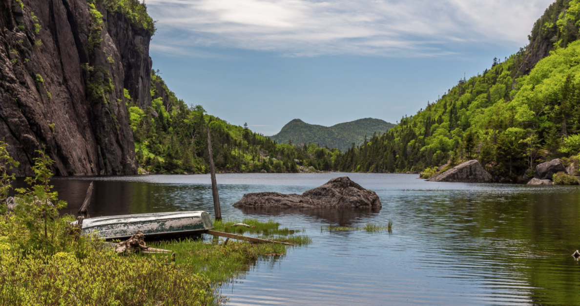
Avalanche Pass and Avalanche Lake Trail, Adirondack Mountains
Distance: 10 miles
Elevation Gain: 1,335 feet
Trailhead:Avalanche Pass + Lake Coordinates
This is hard hike that requires climbing along ladders and bridges that are directly into the cliff walls surrounding a lake. If this one sounds a bit crazy for you, there are other ways to take in the gorgeous views of Avalanche Lake that start from the same trailhead.
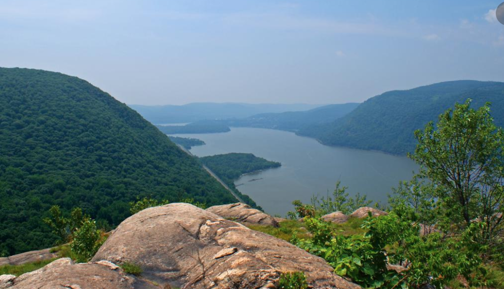
Breakneck Ridge Hike, Hudson Valley
Distance: 3.7 miles
Elevation Gain: 1400 ft
Trailhead: Breakneck Ridge Coordinates
Looking for gorgeous views closer to New York City. Head to Hudson Valley to Breakneck Ridge. It’s easy to get to from NYC (there is a direct train there on the weekends) and the views of the Hudson River are spectacular. There are several different routes you can take. The first part of the hike is the most challenging. There are several spots to stop and take in the panoramic views. I recommend bringing lunch or at least some snacks as there are no facilities along the trail.
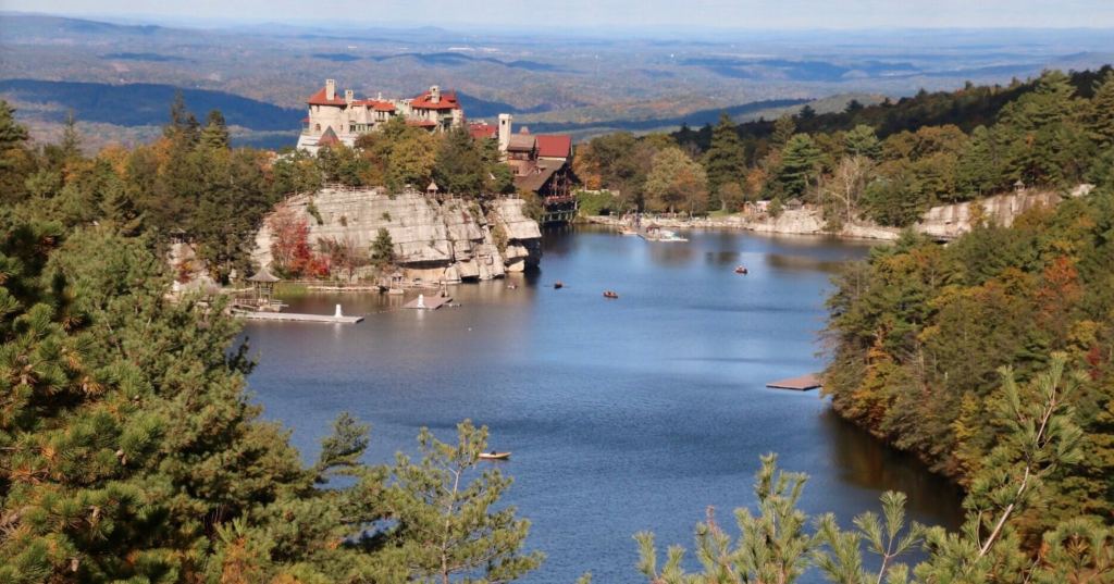
Labyrinth & the Lemon Squeeze, Mohonk Preserve
Distance: 1 mile loop
Elevation Gain: 291 feet
Trailhead: Park here (but beware of cost)
While in the Hudson Valley, check out one of the less risky hikes. This route will force you to crawl and climb across The Labyrinth, then take the ladders up to 360 degree views of 6 states! This hike starts from the historic Mohonk Mountain House. The downside is that it cost $22 per person although there are other places you can start the hike from and pay much less.
Devil’s Path, Catskill Mountains
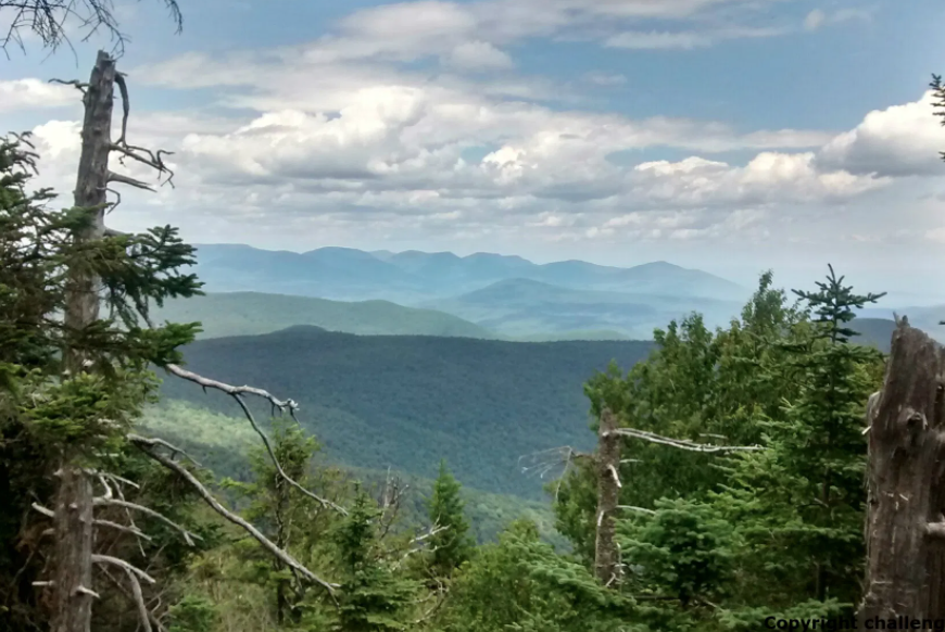
Distance: 21.8 miles (although you can shorten it and do just one half)
Elevation Gain: 8,172 feet
Trailhead: Start Devil’s Path Here on the east side on Prediger Trail Head Road
Known for being one of the most difficult hikes of its kind in the northeast U.S. While there are many ways to hike Devil’s Path, the eastern half which takes you over 4 of the Catskill’s 3500 peaks – Indian Head, Twin, Sugarloaf and Plateau. The trail is generally done east to west. Devil’s Path can be split into two sections with Stony Clove as the geographic reference point. Progression on the trail depends on your fitness, pack weight, comfort on steep terrain, time of the year, trail conditions, and things that may be out of your control (i.e., weather).
Hazards:
- Weather (storms, temperature changes, windchill)
- Steep ascents
- Steep descents
- Lack of water, water is rare on the trail especially in summer
- Snow and ice can linger well into May
- Winter starts early and ends late
The Beehive, Acadia NP
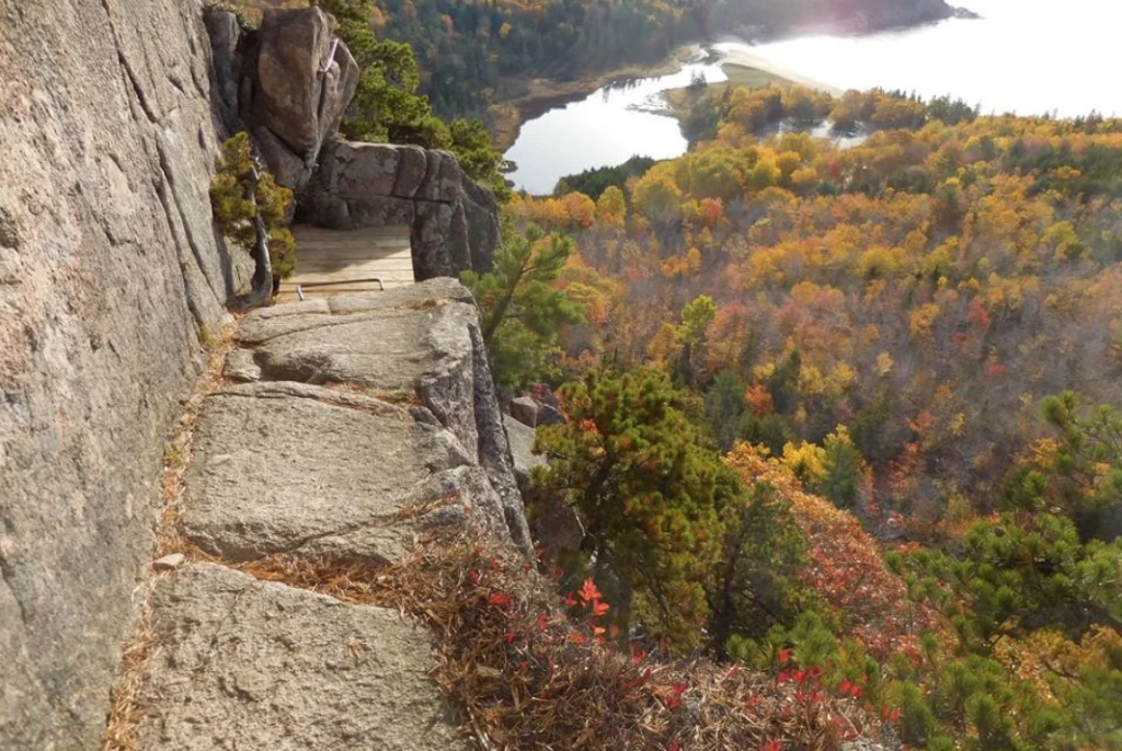
Distance: 1.6 miles round trip
Elevation gain: 520 feet
Trailhead: Beehive Trailhead Coordinates
The Beehive Trail is an epic hike because of the many technical aspects. It is named after the beehive shape of the cliff. The Beehive is the impressive peak that overlooks Sand Beach from the northwest. The hike up the Beehive Trail (aka. the Beehive Cliffs Trail) is a thrilling Acadia classic, but it is not recommended for anybody with a fear of heights. Hungry? The classic place to relax in Acadia National Park is the Jordan Pond House. Check it out!